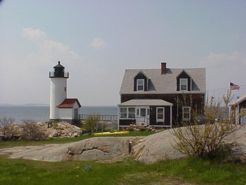
Annisquam Light

|
Annisquam Quick Facts
Year Station Established: 1801
Is the Light operational? Yes
Year Light First Lit: 1897
Year Automated: 1974
Shape: Cylindrical
Tower Height: 41 ft.
Original Optic: 5th Order, Fresnel
Present Optic: 190mm
Existing Keepers Quarters? Yes
Year Constructed: 1897
Number of Stories: 1.5
Architectural Style: Shingle
Construction Materials: Wood
|
Annisquam Lighthouse
Gloucester, MA
More Photos
(4 photos, 92KB total download)
|
Last Visited: May, 2000
History:
To help mariners from running aground on dangerous Squam Bar, the government decided to erect a lighthouse at Wigwam Point in Annisquam. The present Annisquam Light, which has also been known as Squam Light and Wigwam Light, is the third at this location.
In 1801 the United States government bought the property from the Commonwealth of Massachusetts for $140. A 32-foot wooden tower and a wood framed keeper's house were built, andthe house still stands with some modifications.
The present 41-foot Federal-style brick tower was built in 1897. In 1922 the kerosene-fueled light and fifth order Fresnel lens were removed and replaced by an electrified fourth order lens. The new light increased Annisquam Light's brightness from 1,300 candlepower to 250,000 candlepower.
A fog horn was installed in 1931, but the following year it was decided that the signal would only operate from October 15 through May 15 so summer residents could have peaceful nights. In 1949 it went into operation in the summer, but only during the day.
Source:
New England Lighthouses - A Virtual Guide
Personal Note:
2010-10-19 - I received an email from a member of the Coast Guard via our website informing me that there is no longer any parking available at the lighthouse. Here is the text of the email:
Message: i just wanted to inform you that there has been a change to the parking at Annisquam light house. there is now no parking at the residance located at the light house. i was just wondering if you could make that change on you site for the public.

Latitude/Longitude: 42°39'N 70°41'W
Nearest Address: 36 Norwood Heights, Gloucester, MA
Directions:
- Take Route 128 north into Gloucester.
- At the Rotary go around to 9 o'clock and take the exit for Route 127.
- In 3.2 miles take a left onto Leonard St.
- in 0.3 miles turn right onto Norwood Heights Rd.
- In 0.2 stay right onto Norwood Heights.
- As soon as you turn right, now turn left onto Wigwam St.
- The lighthouse is located at the end of the road.
View Larger Map
|


|


